|
 |
|||||||||||||||||||||||||||||||||||||||||||||||||||||||||||||||||||||||||||||||||||||||||||||||||||||||||||||||||||||||||||||||||||||||||||||||||||||||||||||||||
|
||||||||||||||||||||||||||||||||||||||||||||||||||||||||||||||||||||||||||||||||||||||||||||||||||||||||||||||||||||||||||||||||||||||||||||||||||||||||||||||||||
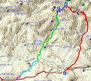
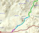
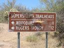
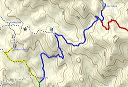
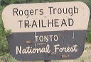
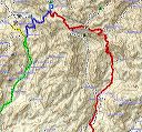
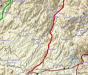
| Maps and Directions to the Woodbury Trailhead and Rogers Trough Trailhead
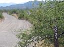
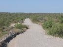
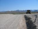
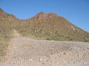
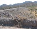
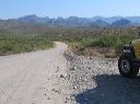
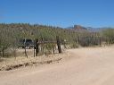
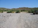
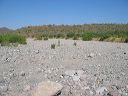
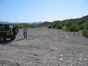
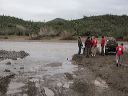
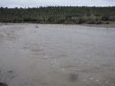
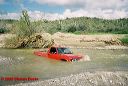
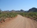
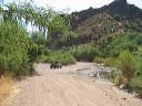
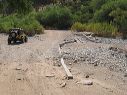
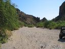
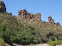
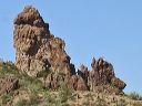
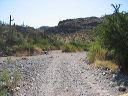
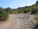
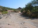
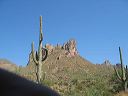
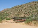
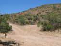
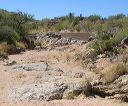
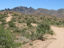
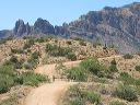
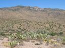
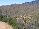
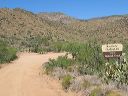
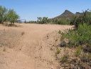
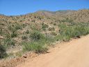
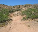
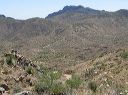
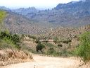
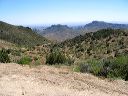
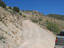
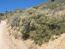
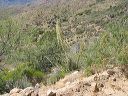
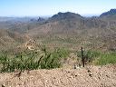
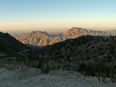
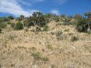
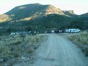
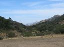
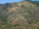
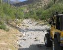
The Woodbury and Roger's Trough trailheads in the Superstition Wilderness are northeast of Florence Junction on FR-172, FR-172-A, FR-172B. Moderate clearance passenger cars can often make it to the Woodbury Trailhead. High-clearance and 4WD is needed to get to the Roger's Trough trailhead. The road is typically closed several times a year at the crossing of Queen Creek due to high fast flowing water (see photo 20). FR-172 has several more unbridged crossings and heavy rain can rearrange sand and rocks making it impossible for passenger cars to cross even after the water subsides. The drive takes close to 2 hours from the US-60 and Loop 101 interchange in Tempe. The driving time is variable depending on the road conditions, your vehicle, and your comfort driving narrow mountain roads--the last 15 miles are unpaved and can take anywhere from 45 minutes to double that. It normally takes me 20 minutes for the 4 miles from the Woodbury turnoff to Roger's Trough. I seen reports of people needing 45 minutes for those 4 miles! - Take US 60 east out of the Phoenix Area past Florence Junction (US-60 and SR-79). The Woodbury Trailhead is straight ahead 1.5 miles (turn right at the gate) on FR-172B. For the Roger's Trough Trailhead, make a right turn onto FR-172A - Most of FR-172A is a one lane shelf road with few pullouts and blind curves. Drive slowly and scan the road in the distance to prepare for oncoming traffic. The last mile into Roger's Trough requires high clearance 4WD due to washouts on fairly steep uphills. There may be 12" rocks in the road for the final 0.3 miles--depending on whether the last rain added or removed sand from the wash. Trails out of (or nearby) the Woodbury trailhead include: JF-Trail, Coffee Flat Trail, Woodbury Trail, Millsite Canyon Trail, Randolph Canyon Route, and the Whetrock Canyon Route. Trails out of the Rogers Trough trailhead include: Reavis Ranch (Valley) Trail, and the West Pinto Trail. FR-650 at the Rogers Trough Trailhead can be used as an alternate return route. It is a somewhat more difficult drive. It is a narrow shelf road with tighter switchbacks than FR-172A. If the crossing at Queen Valley is closed due to water, FR-650 will also be closed since parts of the road run down a wash (see photo 77). The upper section closelly follows the Superstition Wilderness boundary and provides access to several trailheads: Reavis Trail Canyon trail (both ends), Spencer Spring Trail, Rock Creek Route, and a southwest route to Tony Ranch Cabin and Haunted Canyon. |
||||||||||||||||||||||||||||||||||||||||||||||||||||||||||||||||||||||||||||||||||||||||||||||||||||||||||||||||||||||||||||||||||||||||||||||||||||||||||||||||||
 |
 |
|||||||||||||||||||||||||||||||||||||||||||||||||||||||||||||||||||||||||||||||||||||||||||||||||||||||||||||||||||||||||||||||||||||||||||||||||||||||||||||||||
|
Click a thumbnail to see the full size image. Then use the Previous and Next thumbnails to
directly move among the full size images without having to return to this page each time. |
||||||||||||||||||||||||||||||||||||||||||||||||||||||||||||||||||||||||||||||||||||||||||||||||||||||||||||||||||||||||||||||||||||||||||||||||||||||||||||||||||