|
 |
|||||||||||||||||||||||||||||||||||||||||||||||||||||||||||||||||||||||||||||||||||
|
||||||||||||||||||||||||||||||||||||||||||||||||||||||||||||||||||||||||||||||||||||
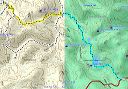
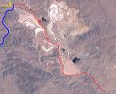
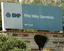
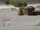
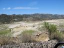
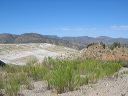
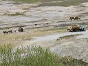
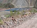
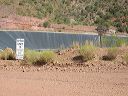
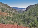
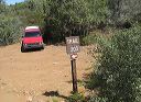
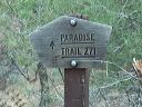
| The drive to the Miles Trailhead in the Superstition Wilderness is a study in contrasts. In order to reach the wilderness, you first drive through the active Pinto Valley copper mine. Copper was first discovered in the area in 1881 with the first major production in 1943. Current operations are an open pit copper sulfide mine and acid leach pits. For more photos of the mine, see my "BHP Pinto Valley Mine" photos under the Superstition Landmarks heading.
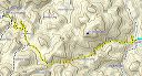
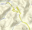
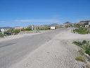
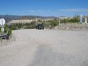
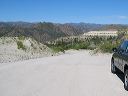
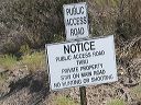
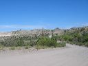
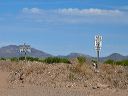
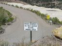
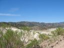
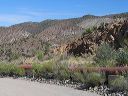
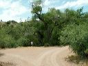
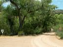
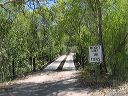
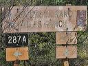
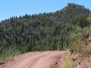
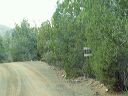
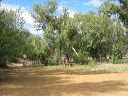
FR-287 heads north from US-60 12.4 miles east of SR-177 in Superior. Past the mine, you'll turn left onto FR-287A to reach the Miles Trailhead. You'll pass several other trailheads along the way. - It takes about 20 minutes to get from US-60 to the eastern Haunted Canyon Trailhead which is just south of the FR-287 bridge over Pinto Creek Moderate clearance passenger vehicles shouldn't have problems on the FR-287 section through the mine. (Don't forget that a passenger car loaded with six adults will have greatly reduced ground clearance.) Continuing on FR-287A may be possible in a passenger car, but the drive will be less stressful with a truck or truck-based SUV at least on your first visit. There are some washouts and unbridged crossings that change from month to month. You won't want to drive FR-287a if there's snow or ice since the first part is a one lane shelf road --see ph0to 28. There's a permanent mudhole at the ranch but if it's blocking the road that only adds a couple hundred feet to your hike. |
||||||||||||||||||||||||||||||||||||||||||||||||||||||||||||||||||||||||||||||||||||
 |
 |
|||||||||||||||||||||||||||||||||||||||||||||||||||||||||||||||||||||||||||||||||||
|
Click a thumbnail to see the full size image. Then use the Previous and Next thumbnails to
directly move among the full size images without having to return to this page each time. |
||||||||||||||||||||||||||||||||||||||||||||||||||||||||||||||||||||||||||||||||||||