32 of 69
Previous
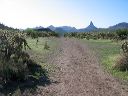
Black Mesa Loop
This is part of the steep descent shown near the center of the hike elevation profile.
Next
Location:
• Latitude: N 033° 28' 09.89"
• Longitude: W 111° 24' 09.19"
• Altitude: 778.00m
Date:
4/23/06 8:32:41 AM
W x H:
2272 x 1704
Albums:
web Black Mesa Loop