4 of 15
Previous
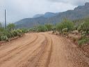
Road to Upper Horrel Trailhead aka Campaign Trailhead
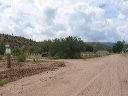
The ranch is straight ahead. FR 449a to the trailhead turns to the left.
Next
Location:
• Latitude: N 033° 39' 44.75"
• Longitude: W 111° 07' 25.26"
• Altitude: 695.00m
Date:
9/4/04 10:53:27 AM
W x H:
800 x 600
Albums:
web Upper Horrell Trailhead