|
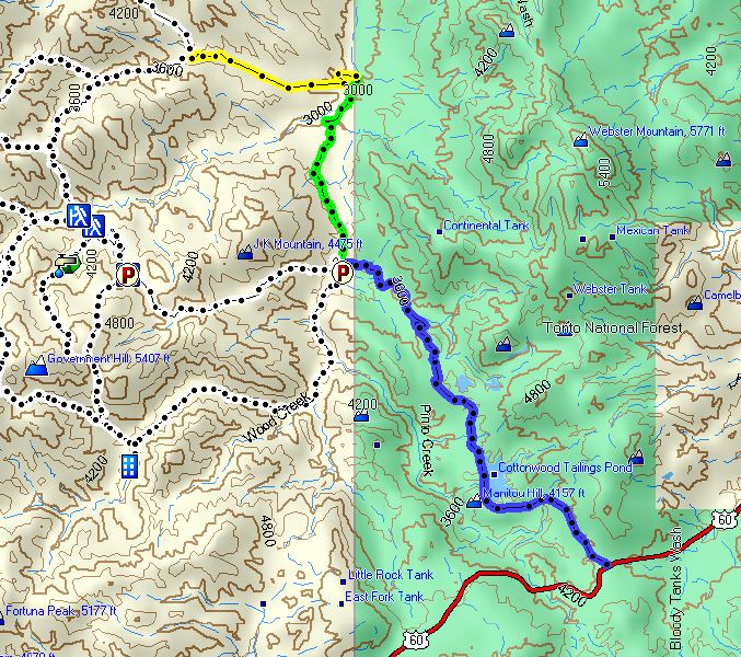
Road to Cuff Button Trailhead:
At bottom right is US 60 at Pinto Valley Road FR-287 (east of Superior). The blue dots are FR-287 through the BHP mine north to the bridge over Pinto Creek. The green dots are FR-287 north from the bridge to Horrel Ranch. The yellow dots are the creekbed route from the ranch to the Cuff Button trailhead.
|