9 of 77
Previous
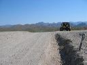
Roads to Woodbury and Rogers Trough trailheads:
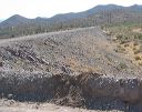
Looking west at an unofficial shooting range atop the levee.
Next
Location:
• Latitude: N 033° 19' 13.12"
• Longitude: W 111° 14' 22.94"
• Altitude: 681.00m
Date:
7/17/05 8:54:31 AM
W x H:
2272 x 1704
Albums:
Queen Valley Explore, FR-172 to Woodbury and Rogers Trough