68 of 77
Previous
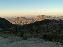
FR-172A to Roger's Trough Trailhead
Climbing into Pinon Pine country.
Next
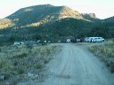
Location:
• Latitude: N 033° 25' 11.78"
• Longitude: W 111° 10' 27.95"
• Altitude: 1,478.00m
Date:
6/26/04 8:21:13 AM
W x H:
2272 x 1704
Albums:
Roger's Trough TH, Road to Rogers Trough, FR-172 to Woodbury and Rogers Trough