Previous |
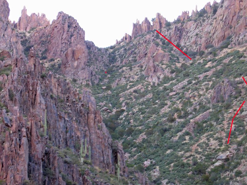
Alternate Route to Flatiron on Superstition Mountain
There's a hiker (white dot) to the left of the red dot on the most used route up Siphon Draw. This approximation of the alternate route is marked in red. It has lots of small loose rock on steep slopes but avoids the 10 foot rock wall near the top of the draw. I came down via the draw. The loose rock on the marked route would make for a slow descent on all fives! Feet, hands, and seat of the pants.
|
Next |