Previous |
Alternate Route to Flatiron on Superstition Mountain
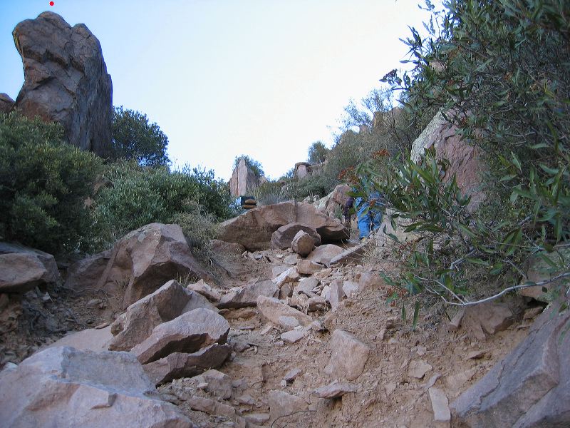
The red dot is above the same rock as the prior photo. The upper section turned out to be a relatively easy: It wasn't near as bad as it looked from afar, the rocks aren't too big, or too small and lose... (There are two hikers ahead of me. The upper one is on all fours.)
|
Next |